
Words by Linda Hubbard
There’s a show taking place on the Peninsula—and it’s all yours for free, or nearly so. Thanks to the winter rains, wildflowers are springing up all over our local nature preserves. A kaleidoscope of color sweeps the landscape with sunset orange California poppies, the yellow and white petals of tidy tips and spiky stems of purple lupine. Now—while skies are likely to be clear, ahead of summer’s fog—is a great time to lace up your trail shoes or hiking boots and see them up close.
For a bounty of blooms and scenery that puts a spring in your step, visit these four parks offering distinct experiences, from a good ramble to more strenuous outings. A gentle reminder for visitors: take photos not flowers. Leave plants and wildlife undisturbed so that everyone can appreciate them.
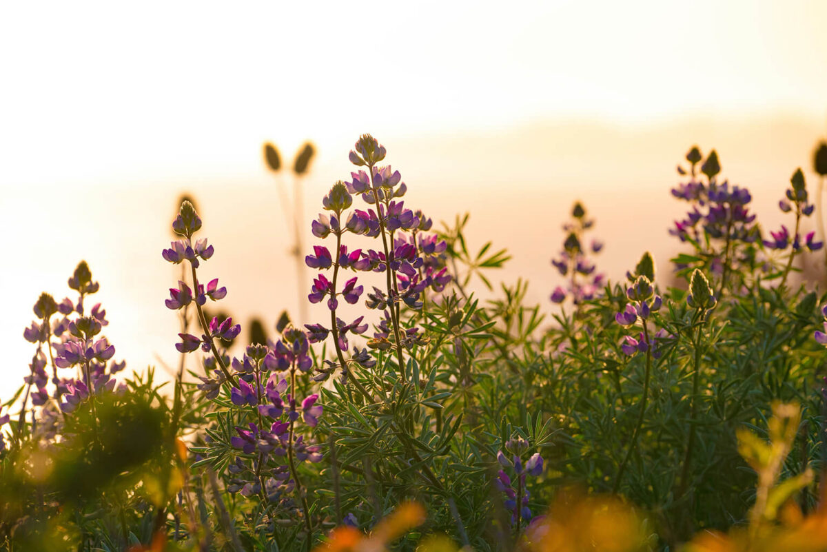
Enid Pearson-Arastradero Preserve
Ten and a half miles of trails loop up and around a nice mixture of oak woodland and grassland. This City of Palo Alto-owned, 622-acre preserve is at its greenest in March—and punctuated with wildflowers. It’s named for former City Councilwoman Enid Pearson, who was instrumental in passing the 1965 ballot measure that prohibits Palo Alto from selling any park land without voter approval.
Set your sights on a number of good hilly loops, or take an out-and-back trail along Arastradero Creek for gentler terrain. First-time visitors may be surprised to encounter so much wildlife so close to suburbia. You’re likely to spot wild turkeys and deer, and may even catch a glimpse of a coyote or bobcat disappearing into the purple needlegrass and blue wild rye.
GOOD TO KNOW

+ The main parking lot has an interpretive center and is located at 1530 Arastradero Road, Palo Alto
+ Terrain is packed gravel with a few rocky sections
+ Open to hikers, cyclists, equestrians and leashed dogs
+ Restrooms located at the parking lot
+ Find more information and a trail map at cityofpaloalto.org/parks
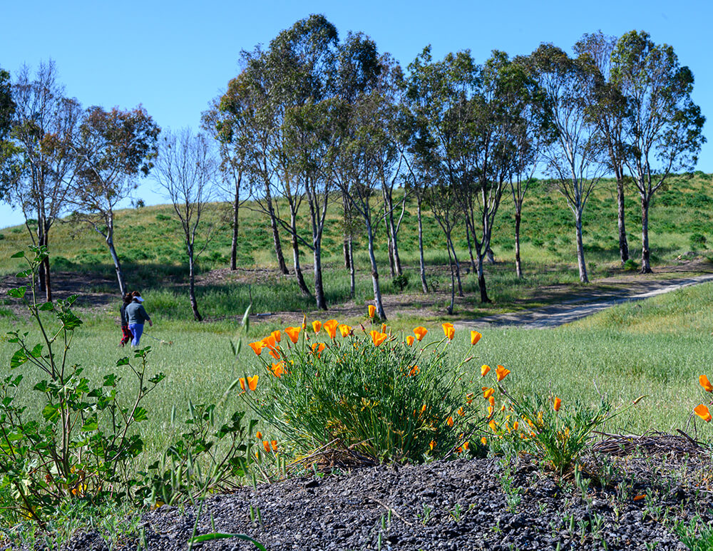
Photo: Courtesy of Robb Most
Bedwell Bayfront Park
Longtime residents may remember when Bedwell Bayfront Park was a landfill before it was capped in the 1980s. Covering 160 acres, the dog-friendly park shares some of the same attributes as Arastradero—there’s water and wildlife, but of a very different sort, specifically shorebirds drawn to its salt marshes along the San Francisco Bay that surrounds it on three sides.
Popular with bird watchers and kite flyers, it’s also a picturesque place to spread out a picnic blanket and watch the clouds. Walkers can take a relatively flat 2.3-mile trail around the perimeter. Bedwell’s interior trails are hilly with some good up and down pulls for those seeking more strenuous activity, along with breathtaking views across the Bay.
GOOD TO KNOW

+ The park is located at 1600 Marsh Road, Menlo Park
+ Terrain is mostly unpaved dirt
+ Open to hikers, cyclists, and leashed dogs
+ Restrooms located at the first paved parking lot
+ Find more information at menlopark.gov/parks
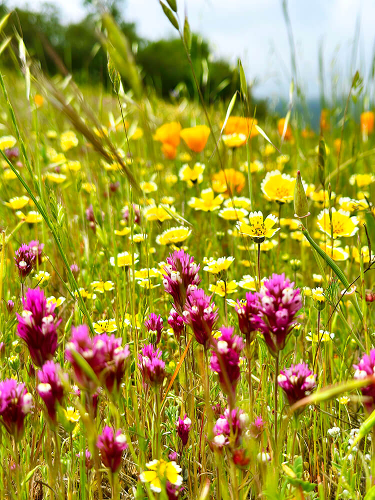
Photo: Courtesy of Frances Freyberg
Edgewood County Park & Natural Preserve
Driving along Highway 280, you can catch a glimpse of the showcase that permeates Edgewood Park in the spring—not just a sprinkling of wildflowers but also carpets of colorful blooms like goldfields and purple-blue lupine.
What makes its wildflower display unique is its serpentine soil, which inhibits invading non-native plants and allows well-adapted natives to thrive. Keep an eye out for the telltale flutter of the white, black and orange wings of the rare Bay checkerspot butterfly. The species thrives at Edgewood, where its caterpillars fatten up on a diet of California plantain and owl’s clover.
Covering 467 acres, 10 miles of trails wind along its woodlands and grasslands. There’s a bit of climbing, but it’s fairly gentle, and the trail surface is free of rocks and other potential ankle-twisters.
For a quick jaunt and easy access to the preserve and its 550 varieties of plants and wildflowers, park along Cañada Road just south of Edgewood Road and enter the park via the Clarkia Trailhead.
GOOD TO KNOW

+ Main parking lot is at 10 Old Stage Coach Road, Redwood City
+ Terrain is dirt
+ Open to hikers and equestrians; no dogs or cyclists
+ Restroom in the picnic area near parking lot
+ Find more information and a trail map at smcgov.org/parks
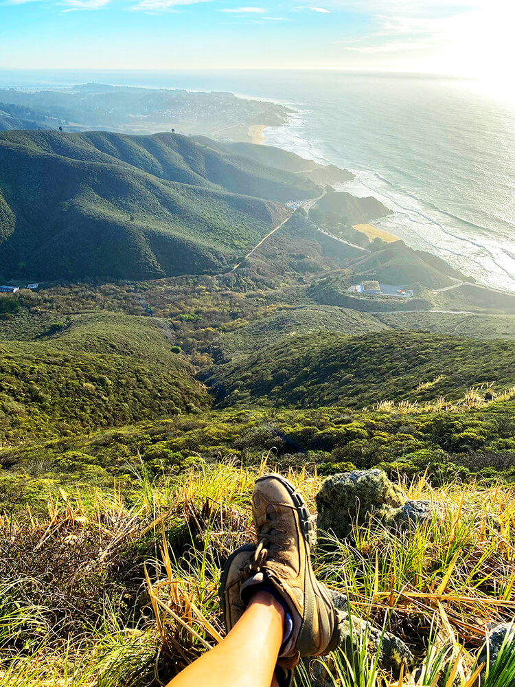
Photo: Courtesy of Frances Freyberg
Montara Mountain Trail
On clear spring days, the butt-kicking Montara Mountain Trail provides glorious views out over the Pacific Ocean. Just over two miles in length, the elevation change surges 1,174 feet. Those not keen on making the full ascent can circle back on the Brooks Creek Trail.
Along the way you’ll weave through a towering blue gum eucalyptus forest, pass large granite rock formations and encounter the unique Montara manzanita, a shrub with tightly bunched blooms that only grows on this mountain.
The trail is part of the 1,052-acre San Pedro Valley Park located in the northernmost part of the Santa Cruz Mountain range. It’s also home to Brooks Falls, the tallest waterfall in San Mateo County, dropping 207 feet off of Montara Mountain—and mostly visible after a significant rain.
GOOD TO KNOW

+ Located at 600 Oddstad Boulevard, Pacifica
+ Terrain is dirt; lots of switchbacks
+ Open to hikers and equestrians; no dogs or cyclists
+ Restroom at the visitors center
+ $6 entry fee
+ Find more information and view a trail map at smcgov.org/parks